-40%
Los Angeles GOLD MINES, Calif; SF Valley, fossils, 5 BIG sep maps, RARE 1st ed!
$ 49.51
- Description
- Size Guide
Description
Rare 1958 1st ed. details gold mines& fossils in San Fernando Valley, CA
Use the five big, separate maps in the
rear pocket to find exact locations
Visit these rich sites just around the corner
when you don't have time to leave town
You won't find one of these books in better shape!
T
his book locates and describes old mines and fossil deposits hidden around the San Fernando Valley.
Small detail from large color map in rear pocket shows just three of the quadrangle's gold deposits — marked with crossed-pickaxes and "Au," the elemental symbol for gold. Numbers correspond to description and exact location of mine in text. For example, gold mine 24 — located in the Tick Canyon area — is the Utopia, also known as the Champion, Dietzman, Enterprise or Shepherd.
That's right! Who woulda guessed? Gold mines to visit right around the corner. Sometimes the most interesting sites are hidden in plain sight right under your nose.
First edition is
hard to find
The San Fernando Valley is so geologically interesting that it rated this ENTIRE 147-page hardcover report. This first-edition book is now harder to find than a snowball in Death Valley, especially in this condition, which is very good.
This is the
only
comprehensive government report ever published about the geology, mines and fossils of the San Fernando quadrangle.
Has all the maps!
In almost 12 years of buying and selling on ebay, I have only seen a few of these books offered for sale. And almost all of those are in ragged shape, missing maps or both.
Of course, you should know by now that I'm not going to sell a book with missing maps. This copy has all five maps in the rear pocket. All are in very good condition.
So buy it now or forever hold your peace. Once it's gone; it's gone.
Has six-page list of mineral
deposits, including gold prospects
This first-edition book has a six-page alphabetical list of mineral deposits and a 4.5-page list of oil wells. In the section on mineral deposits, each deposit is alphabetically listed by material mined and mine name — including
24 gold prospects.
We have many MANY more rare mining books! Just search for our ebay store, Rare Mining Books:
http://stores.ebay.com/Rare-Mining-Books?_rdc=1
Also described are locales for lead-silver-zinc ores, beautiful chalcedony and opal (yes-opal!), asbestos, borates, graphite, gypsum, ilmenite-magneitite and mica. The description of each mineral deposit contains history of the mine and operational details (sometimes even owners' names and addresses). Mine descriptions run from a few lines to a paragraph, depending on importance of the deposit.
All mine locations are given in exact coordinates
More importantly, this book gives exact locations of the deposits, sometimes using landmarks, but almost always using
infallible range-and-township coordinates
. Just plug 'em into your GPS or look 'em up on the appropriate topo, and you're there!
Twenty-five of California's 78 mineral commodities have been found in this quadrangle, and 11 of them have been produced in significant amounts. Total mineral production from the quadrangle up until 1953 was estimated at million.
Small detail from full-page map in book shows just seven of more than 32 fossil locales located and described in report. These particular fossil locales are just a few miles from downtown San Fernando, lower right, and just north of the Los Angeles City boundary.
Fossils, fossils and more fossils
The author devotes seven or eight pages almost exclusively to fossils and fossil locales (see map above). These pages are largely easy-to-follow tabular lists of what fossils were recovered from what formations. Locations are usually in very exact range-and-township coordinates.
The types and ages of fossils in this quadrangle are truly extraordinary — from microfossils to plant-leaf impressions, from sea shells to sea-mammal (cetacean) bones, from ficus leaves to worm borings. If you collect fossils in the Los Angeles area (or ever plan to), this book is a must. In the Elsmere Canyon area alone, 60 distinct fossils are listed as coming from the easily recognizable basal sandstone there: Cetacean and camel bones,
arca trilineata
,
cardium
,
dosinia ponderosa
,
pecten ashleyi
,
solen sicarius
,
calyptraca filosa
,
fusus barbarensis
,
mangilia
,
turritella cooperi
,
turris fernandoensis
and many, many more.
This is not some gift-shop rockhound book; it was prepared by the California Division of Mines 44 years ago in 1958. It's a 147-page treasure trove of information for history buffs, bottle collectors, photographers, geologists, hikers, metal detector enthusiasts, offroaders, rockhounds, fossil collectors, prospectors — just about anyone interested in learning about and exploring the quad's unique geology or prospecting old mine sites.
Here are some of the gold mines described:
The Utopia (also known as the Champion, Dietzman, Enterprise or Shepherd), in the Tick Canyon area
, four parallel quartz veins two to four feet wide, five lode claims continuous with Spanish claims, with about 1,000 to 1,200 feet (!!) of tunnels and several 100 feet of shafts. Leased to Daniel Webster et al., 14906 Lemoli Ave., Gardena.
The Fox No. 2, northwest of Bouquet Canyon
, "one of a number of placers," in Coarse Gold Canyon, active in 1932–'35, sporadically mined until 1948. Is any gold still there? Use the maps and coordinates and find out for yourself!
Alexander, owned by John Alexander (1948), Pacoima Canyon at Noel Canyon
, 40-foot shaft in north side of quartz lode, carrying sulfides of iron and copper.
Little Nugget Placers
, including Little Nugget 1 and 2, patented; owned by Mrs. Ada R. Brown, Box 27, Route 2, San Fernando. In Gold Creek, placer gold produced intermittently from 1918 to 1947. Now idle (1958). Total value is perhaps several thousand dollars.
Fighting Bob No. 1
, owned by Abel Collins of Salinas.
Don't waste time
with secondhand information
You can't look for "color" in mine dumps or in seasonal streams if you don't know where the best dumps or the most productive streams are. Don't waste weekends panning or
randomly digging for fossil specimens. Okay, so you have a book by a "noted rockhound" or an "ace prospector." You might get lucky and find a couple of neat places, but you'll also hit plenty of barren duds. Why? Because what rockhound, mine explorer, paleontologist or prospector in their right mind would give away their favorite productive locations? Not one.
The composition of Vasquez Rocks — and what caused their formation — is fully discussed. Below right: Tiny detail of large map from book shows rock units and faults, including those around the San Fernando Reservoir near Mission Hills.
What they will give you are directions to sites that are picked clean or second rate at best. Don't rely on secondhand info when you can get it firsthand. I guarantee that most — if not all — tourist-oriented rockhound and prospecting books for Los Angeles County use this 8.5-by-11-inch hardcover report as a prime source for information.
Want to pan or collect at virgin locations instead of ones already known? Then you'll need to find new areas with geologic attributes conducive to forming the fossils or minerals that you're seeking. This sought-after book has that information too (see map elsehwere in ad).
Obviously, this book also covers earthquake faults, major and minor, such as they were known in 1958; after all, the San Gabriel fault runs directly through the quadrangle, and the two largest earthquakes of recent record in Los Angeles had epicenters in the quadrangle or nearby: The so-called Sylmar quake of February 9, 1971, which registered a deadly 6.6 on the Richter scale, was centered in Lopez Canyon near Sylmar. The quake of January 17, 1994 (a slightly stronger 6.7 on the Richter) had its epicenter in nearby Northridge.
Map shows location of San Fernando quadrangle in relation to Los Angeles, Pasadena, Azusa, Palmdale, Lebec, Antelope Valley, Acton, San Gabriel Mountains, Santa Susana Mountains, San Fernando, Saugus, Castaic, San Andreas Fault and San Gabriel Fault.
Book describes geology in detail
Because this is, after all, a book about mining
and
geology, it covers the latter topic in minute detail. The east-central part of the quadrangle — the western end of the pre-Tertiary crystalline massif of the San Gabriel Mountains — is an area of rugged topography and high relief, topped by Magic Mountain, elevation 4,878 feet.
Pre-Cambrian rocks include the Mendenhall gneiss and the anorthosite-gabbro group that intrudes the gneiss. The Precambrian rocks crop out over an area of 91 square miles north of the San Gabriel fault. Three groups of rocks of undeteremined age represent time between late Precambrian and early Cretaceous.
Of course, the text contains far, far more detail about geology — especially how it relates to mineral deposits and their formations — than just the previous two paragraphs. Geology varies widely over an area the size of this quadrangle, so it is impossible to convey but the simplest geologic features in an ad.
Small detail from large oversize map in pocket shows four more gold deposits, marked with "Au," the elemental symbol for gold.
Where is it?
San Fernando quadrangle (see map above) includes about 245 square miles of the western end of the San Gariel Mountains. The northern part of the quadrangle extends across Soledad Canyon to the southern margins of the Sierra Pelona. The southwestern part of the quadrangle includes the city of San Fernando, Sylmar, Mission Hills, Pacoima and part of the San Fernando Valley; in the southeast are the towns of Sunland and Tujunga and part of the Verdugo Mountains. Los Angeles City Hall is about 13 miles due south of the southeast corner of the quadrangle.
Also included in the quadrangle are Canyon Country, Placerita Canyon State and County Park and Vasquez Rocks County Park.
The book:
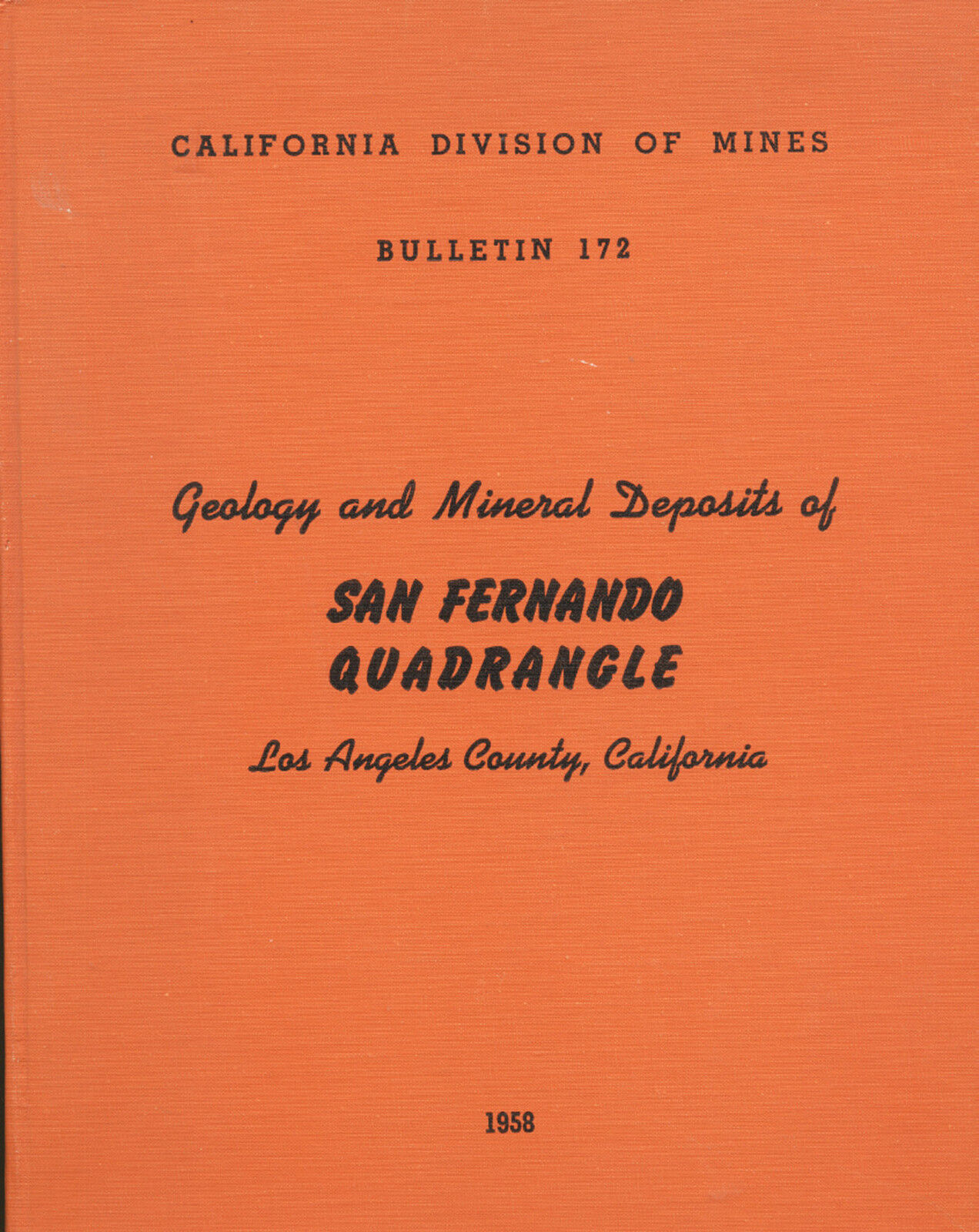
Geology and Mineral Deposits of San Fernando Quadrangle, Los Angeles, California
, Bulletin 172, by Gordon B. Oakeshott, California
Department of Natural Resources, Division of Mines, San Francisco, 1958, first and only edition, 147 pages, 91 photos, 11 tables, five large oversize maps folded in rear pocket (two in color); book is 8.5 by 11 inches, hardcover
(very
unusual for these books), no dust jacket (as issued), very good condition, except for some slight shelf wear, slight soiling to covers, a few cover dings. Ex-library, with some card pockets and stamps, but they do nothing to interefere with readability and usefulness. All-in-all a beautiful copy. You would be hard-pressed to find a copy of this book in better condition.
As always, I am
extremely
conservative about rating book condition and very detailed in listing any potential flaw, no matter how slight. You get what you pay for. If you want a trashed book — filled with scribbled notes, dog-eared pages and underlined passages that the seller just "somehow forgot" to tell you about in his ad — then look elsewhere on ebay.
Payment methods and domestic shipping
Paypal only. I pride myself on bulletproof packaging and ship in sturdy cardboard boxes or STRONGLY reinforced envelopes. Feel free to contact me if you have any questions about the item or terms of sale. I post feedback once a week. Not responsible for typographical errors.
Good luck and thanks for looking!
Looking east up Soledad Canyon, along the Soledad fault, from a point near the mouth of Agua Dulce Canyon, looks substantially different in 1958 than it does today. Note the train and train tracks
The Placerita oil field (above), accounted for million in mineral production until 1953. The large color map (right) from the rear pocket shows how much has changed in just the 43 years since this report was published, making it also valuable for those interested in information on the large impact of urban sprawl in this once-rural area.
Nearby cities and landmarks
Just outside the borders of the quad are Acton, Santa Clarita, Newhall, Reseda, Saugus, Granada Hills, Panorama City, La Crescenta, Verdugo City, Montrose, Sun Valley, La Canada Flintridge and, of course, the City of Los Angeles. Within a few miles drive are Burbank, Glendale, Pasadena, Altadena, Mount Wilson, Sierra Madre, North Hollywood, Van Nuys, Winnetka, Canoga Park, Chatsworth, Castaic, Palmdale and the Los Angeles National Forest. The quadrangle is in Los Angeles County. Adjacent counties are Orange, Ventura, Kern, San Bernardino and Riverside.
