-40%
GOLD MINES, Nye County, NV, Las Vegas, Death Valley, 1st ed, BIG separate maps !
$ 31.03
- Description
- Size Guide
Description
Book locates all gold and silverdeposits in southern Nye County, NV
Covers 23 mining districts, like the rich Johnnie District near Pahrump and Las Vegas; more near Death Valley
Only 3,000 copies ever printed; has two ++BIG++ separate maps
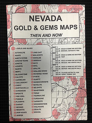
Detail of map from pocket showing rich gold deposits in Rhyolite-Bullfrog District (left) and rich fluorspar deposits "right across the street" in Fluorspar Canyon. Red symbols denote type of deposit. Numbers refer to map key, showing official name of mining district.
T
his report — and two large separate maps — describes and locates all the gold and silver deposits in southern Nye County, Nevada.
Map key from book shows location of area covered by report.
Many of these areas are within a couple hours of Las Vegas! Take some time during your next gambling junket to rake in some REAL gold instead of throwing it all away at the gaming tables! Many of these deposits are the real deal, not just dinky little one-shot pocket mines. Many a desert prospector back in the day started off penniless and went home to the East Coast a rich man after striking it rich big time in these rich gold fields.
Big bucks from Death Valley mines!
Some deposits are near Pahrump in the Johnnie District; others are just outside the borders of Death Valley National Park, including mines in the Rhyolite area (see map below), home of the famous Montgomery Shoshone gold mine, which produced more gold bullion — over .4 million — in the early 1900s than any other mine in the Death Valley area.
Matter of fact, the entire Bullfrog District was
named
after the bright green ore (the color of a bullfrog) discovered at the site of what was to become the Montgomery
Shoshone. Without the Montgomery Shoshone, there would be no reason for the existence of Rhyolite, the queen city of Bullfrog. Now the most famous of all Death Valley ghost towns, Rhyolite is perhaps the most photographed ghost town in North America besides Bodie, California.
We have many MANY more rare mining books! Just search for our ebay store, Rare Mining Books:
http://stores.ebay.com/Rare-Mining-Books?_rdc=1
Treasure trove
of information!
Geology and Mineral Deposits of Southern Nye County
(cover below left) is not some gift-shop rockhound book; it was written about miners for miners by miners. Prepared by the Mackay School of Mines (University of Nevada at Reno) in 1972, it's a treasure trove of information for history buffs, bottle collectors, photographers, geologists, hikers, offroaders, rockhounds, prospectors — just about anyone interested in learning about, exploring or prospecting old mine sites in historic Nye County, much of which is remote desert wilderness.
Also a valuable tool for
stock certificate collectors
Because this 49-page, first-edition report lists mines, mine owners and mining districts, it is also a valuable tool for collectors of stock certificates. Some mine descriptions contain brief histories of the mines in question (including dates of actual production) and previous owners.
Lists all mineral deposits by mining district
The report alphabetically lists all mineral deposits by district, along with location and operational details, a description that runs from a few sentences to multiple paragraphs, depending on the importance of the deposit.
Tiny detail from large map from pocket shows geology of area around Devils Hole section of Death Valley National Park, a section of the park in Nevada that is physically separated from the main body of the park.
The report is packed with geologic information, ore value, mine production stats, history, sometimes even claim
holders' names and addresses.
This report is considered primary source material; much of this info is available
nowhere else
. It is a first edition (with a limited press run) in near fine condition. So buy it now or forever hold your peace. Once it's gone, it's gone.
Some of the districts and mines in southern Nye County that are described in the book:
Antelope Springs District, 30 miles southeast of Goldfield
, on the slope of the Cactus Range. Discovered in 1903, the district has produced 10,000–1 million ounces of silver and 10–1,000 ounces of gold, depending on who you believe.
Bullfrog District
(previously mentioned), largest gold producer in southern Nye County; most gold and silver production came from the Montgomery Shoshone mine, three miles west of Beatty, .7 million output (conservative).
Johnnie District, three miles northeast of Johnnie
, northwest flank of the Spring Mountains, second largest gold-producing area, estimated 10,000–100,000 ounces of gold. Locations of top-producing mines in district are given.
Lee Mining District, on the southwest side of the Amargosa Desert
, three to
five miles southwest of Big Dune, free gold in quartz veins.
Queen City Mining District, south end of the Quinn Canyon Range
where it crosses State Highway 25, includes Black Hawk mine, near Railroad Valley; produced 68 flasks of mercury, developed with vertical shafts and adits.
Tolicha Mining District, includes the Clarkdale area
; 0,000 gold-silver ore shipped in the 1930s alone.
Unusual geology detailed
Since this is a geology report after all, it obviously details the area's unusual geology. Southern Nye County is underlain by a wide variety of rocks that range from Precambrian to Quaternary. Older Precambrian rocks, cropping out west of Beatty and east of Mount Helen, consist of gneissic granite, quartz monzonite and quartz-biotite schist. Younger Precambrian rocks (with a
distribution similar to those of paloeozoic age) are composed of quartzite, siltstone, micaceous shale, marble, dolomite and limestone.
Small section of large map from pocket:
Geologic map of southern Nye County, Nevada
. This map can be used to predict locations of new deposits of minerals, including precious metals.
Volcanics cover a large part of the area; some came from calderas. Mesozoic or Tertiary megabreccias are believed to be landslides with sources in ridges as far away as five miles!
Super nice maps!
Despite all the information in the text itself, the two oversize maps in the rear pocket might be the real prize here. Either would look great framed. They're handsome examples of geologic cartography with bright colors (for easy viewing in a dimly lit mine adit) and nicely executed calligraphy. They just don't make 'em like this any more!
No guards, fences
or barking dogs
Many locations in this report are completely accessible, deserted and open to
exploring. You can go anywhere you want at these sites and pretty much do whatever you want, when you want, as long as it's legal. (We do not condone or suggest mine exploring; we're talking the aboveground parts of these locations.)
There are no guards, fences, barking dogs or no trespassing signs. All these mines are miles away from any town of any size and are on federal Bureau of Land Management or Forest Service lands. BLM lands are COMPLETELY open to prospecting and mineral collecting.
Where is it?
Southern Nye County lies along the southwestern boundary of Nevada and is bounded on the east by Clark and Lincoln Counties; on the north by the 38-degree parallel and northern Nye County; on the west by Esmeralda County; and on the southwest by Inyo County, California, home to most of Death Valley
National Park, as well as historically significant mines, including those at Cerro
Gordo, Darwin, Panamint, Modoc and Ballarat.
U.S. Highway 95, connecting Las Vegas with the rest of the state, crosses the county from south to north. State Highway 58 extends southwestward from Beatty and connects with the southern California freeway system. Airports are near Beatty, Tonopah and Pahrump. Cities and towns in Nye County include Amargosa Valley, Beatty, Gabbs, Manhattan, Mercury, Pahrump, Round Mountain, Tonopah, Currant, Duckwater and Rhyolite.
A large part of southern Nye County is now included in the Nellis Air Force Range, the Las Vegas Bombing and Gunnery Range and the Nevada Test Site of the Atomic Energy Commission. Although mines and geology in this area are covered in the text and on the maps, public access is not permitted without special arrangement.
Highest suicide rate in the nation
Nye is the third largest county in United States. Although the Nye county seat is Tonopah, the largest city in Nye is Pahrump. Both the Nevada Test Site and proposed nuclear waste repository at Yucca Mountain are in Nye County.
The U.S. federal government owns 92 percent of the land in the county. With a land area of 11,560,960 acres (46,786 km²), Nye County is larger than the combined total area of Massachusetts, Rhode Island, New Jersey and Delaware. The county also suffers the country's highest per-capita suicide rate.
The report:
Geology and Mineral Deposits of Southern Nye County, Nevada
, Nevada Bureau of Mines and Geology Bulletin 77, by Henry R. Cornwall, MacKay School of Mines, University of Nevada, Reno, Nevada, prepared cooperatively with the United States Geological Survey, 1972, first edition, second printing (only 3,000 copies printed), 8.5 by 11 inches, 49 pages, stapled binding, stiff paper covers. Book and folded maps are in near-fine, like-new condition; maps have some very
slight rippling.
Payment methods and domestic shipping
Paypal only. I pride myself on bulletproof packaging and ship in sturdy cardboard boxes or heavily reinforced padded envelopes. We have been shipping ebay items for over 15 years and have not had one single report of damage from a customer EVER!!! Our attention to detail in packing will amaze you.
Don't see what you want? ASK FOR IT!!!
No matter what old out-of-print U.S. mining book you are looking for, chances are that we probably have it OR can get it for you. Just ask. If we don't have it in stock, we are constantly in contact with a worldwide network of vendors and collectors ... If we can't find it for you, it doesn't exist! We ONLY sell REAL first editions or otherwise official publications. We do not sell cheesy Chinese reprints or other repros of these books.
Large map from pocket shows many geologic features, including springs (like those shown in this tiny detail from map), very important because southern Nye County is largely unpopulated desert wilderness.
The fine print:
Feel free to contact me if you have any questions about the item or terms of sale.
Do not
wait until you bought the report to ask if it covers the forgotten diamond mine of Deadman's Gulch. (It doesn't cover it because I just made up the name.
)
I post feedback once a week. Not responsible for typographikull errors.
Thanks for looking and good luck!!
California counties near Nye
Inyo County — the second largest county in the state — is in eastern California, bordering Nevada, about halfway between the Mexican border and Oregon. It includes the highest point in the contiguous United States (Mt. Whitney) and the lowest (Badwater). Counties adjacent to Inyo are Mono, Fresno, Tulare, Kern and San Bernardino. Nearby counties include: Riverside, Orange, Los Angeles, Santa Barbara, Kings, Madera, Mariposa, Tuolumne and Alpine.
Towns, population areas and interesting sites in or near Inyo County include Aberdeen, the Alabama Hills, Ancient Bristlecone Pine Forest, Argus, Badwater, Ballarat, Big Pine, Bishop, Bullfrog, Cartago, Cerro Gordo, China Lake Naval Weapons Center, Cottonwood Lakes, Coso Junction, Darwin, Death Valley Junction, Dolomite, Dunmovin, Eureka Sand Dunes, Fossil Falls, Furnace Creek, Greenwater, Haiwee Reservoir, Independence, Inyokern, Keeler, Laws, Lake Sabrina, Little Lake, Lone Pine, Mt. Whitney, Olancha, Owens Lake, Onion Valley, Panamint Springs, Pearsonville, petroglyphs, Rhyolite, Saline Valley, Scotty's Castle, Shoshone, Sierras, Sierra Nevada, Stovepipe Wells, Swansea, Trona geology mining mines stock certificate, Tecopa, Ubehebe Crater, Whitney Portal.
Track Page Views With
Auctiva's FREE Counter

