-40%
511 gold mines, Calaveras County, Calif, LAST ONE, 1st ed book, BIG sep. maps VG
$ 93.33
- Description
- Size Guide
Description
Big 1962 1st-ed. book describes and maps 511gold mines in Calaveras County, California
Includes 13 maps in text, plus four
BIG
separate maps
Tiny detail of large map from book's rear pocket:
Map of Calaveras County showing lode gold mines
. Every number here is keyed to mine name and coordinates, plus details about the mine itself. Book includes
another
separate detached large map for placer gold deposits.
I
t would take almost
one year and five months
to visit all 511 gold deposits described in this first-edition book — even if you visited one deposit a day, seven days a week.
Predict and find NEW gold deposits with
Tertiary channels in Calaveras, California,
a full-page map in the book.
This book alphabetically lists all known gold mines and prospects in Calaveras County (
76 pages of them
), along with exact location and operational details of each mine. These descriptions run from a few lines to several pages, depending on importance of the deposit. This 217-page book is also packed with geologic information, mine production stats, history, claim holders' names/addresses, 47 illustrations — including about 13 maps and four oversize, separate maps in the rear pocket (all of them in color).
Book is like new
Want a trashed ex-library book, filled with scribbled notes, dog-eared pages and passages underlined by some first-year geology student? Want the large separate maps to be yellowed and falling apart from being opened and closed 5,000 times? Then look elsewhere. This first-edition report is in like-new condition.
Many of these mines are significant gold deposits.
Mine and Mineral Resources of Calaveras County, California
describes the incredibly rich gold mines in the Mother Lode, East Gold Belt and West Gold Belt, also detailing what rocks and minerals are gold indicators in these geologically different areas.
Also a valuable tool for stock certificate collectors
Because this report lists mine owners and different names for the same mine, it is also a valuable tool for collectors of stock certificates. Some mine descriptions contain brief histories of the mines in question (including dates of actual production) and previous owners.
We have many MANY more rare mining books! Just visit our ebay store, Rare Mining Books:
http://stores.ebay.com/Rare-Mining-Books?_rdc=1
Not a gift-shop book
This book is not some gift-shop rockhound book; it was prepared by the California Division of Mines and Geology some 43 years ago. It's an absolute treasure trove of information for history buffs, miners, bottle collectors, photographers, rockhounds, hikers, geologists, prospectors — just about anyone interested in Calaveras County's historic old mine sites (and working ones too).
How can you look for "color" in mine dumps or in Calaveras County streams if you don't know where the best dumps or the most productive streams are? Don't waste weekends panning every stream in the county or randomly digging through tailing piles for specimens. This book gives exact locations, sometimes using landmarks, but always using
infallible range-and-township coordinates
. Just plug 'em into your GPS or look 'em up on the appropriate topo, and you're there!
Don't waste time with duds
Okay, so you have a book by a "noted rockhound" or an "ace prospector." You might get lucky and find a couple of neat places, but you'll also hit plenty of barren duds. Why? Because what rockhound, mine explorer or prospector in their right mind would give away their favorite productive locations? Not one.
Find new locales for minerals with the
Geologic map of Calaveras County
(only tiny detail shown here from large detached map in pocket).
Scan, below right: Small section of oversize folded map in pocket:
Map of Calaveras gold mines showing placer deposits.
What they will give you are directions to sites that are picked clean or second rate at best. Why rely on secondhand info when you can get it firsthand? I guarantee that most — if not all — tourist-oriented rockhound and prospecting books for Calaveras County use this eight-by-eleven-inch book as a prime source for information.
Want to pan or collect at virgin locations instead of ones already known? Then you'll need to find new areas with geologic attributes conducive to forming the minerals you're seeking. This sought-after book has that too (see scan at top left). It was written about miners for miners by miners.
Here are just a few of the gold mines described:
Arm & Hammer, near West Point.
Bald Eagle, 1.75 miles north of Railroad Flat.
Banner, in Glencoe.
Big Four, 0.5 miles south of Fourth Crossing and just east of Highway 49.
Bowden, five miles northeast of San Andreas.
Crooks and Smith, near Carson Flat.
Colorado, three miles north of Murphys.
Dauphine, one mile southeast of Jesus Maria.
Elite B, three miles northeast of Mountain Ranch.
Plus, literally 100s more of lode and placer prospects, large and small.
Oversize maps in the rear pocket:
Geologic map of Calaveras Couny.
Map of Calaveras County showing lode gold mines..
Map of Calaveras County showing placer gold mines.
Map of Calaveras County showing mines and mineral deposits other than gold.
Illustrations include:
Map showing tertiary channels in Calaveras County.
Map of top of Garnet Hill.
Mill at Penn mine.
Shaft No. 3, Penn copper-zinc mine.
Underground scene, Blackstone gold mine.
Mill of Carson Hill Mining Corporation.
Gwin gold mine, about 1900.
Headframe of Altaville drift mine.
Melones suction gold dredge, Stanislaus River, opposite Melones.
Headframe and hoist house, Lockwood gold mine.
Map of Copperopolis area showing distribution of serpentine and laterite.
Tailings pile at Del Oro hydraulic pit
Map of the Moore Creek mine.
Of course, this book also covers all manner of other Calaveras County minerals: antimony, asbestos, manganese, nickel, platinum, gems, quartz crystals, mercury, zinc, plus many more.
Where is it?
Calaveras County is in Northern California, chiefly on the west slope of the Sierra Nevada. The county is bounded by Amador County on the north, Alpine County on the East and Tuolumne County on the south. San Joaquin and Stanislaus Counties are on the west.
The book:
Mine and Mineral Resources of Calaveras County, California
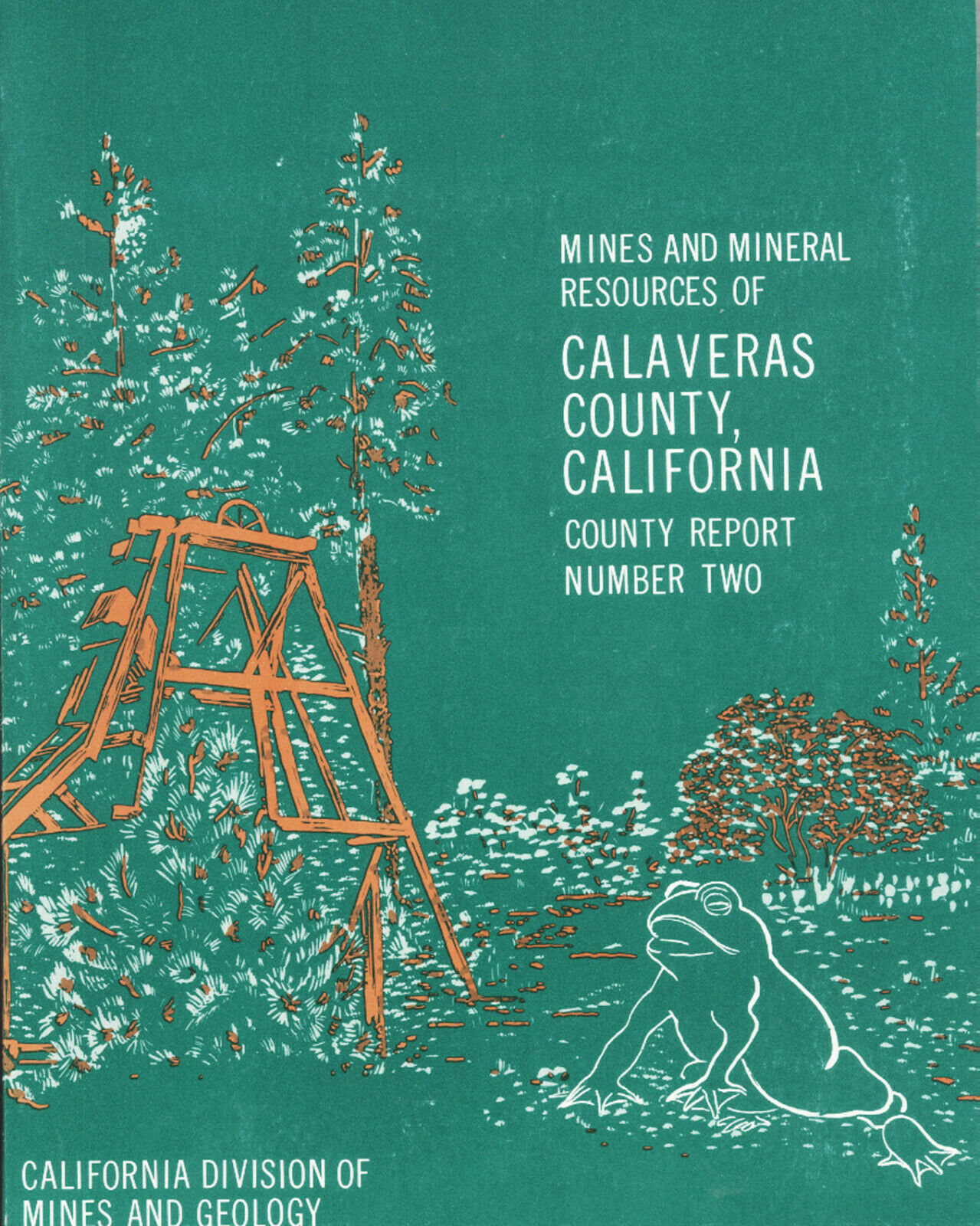
(cover below right), County Report 2, by William B. Clark and Philip A. Lydon, California Division of Mines and Geology, Ferry Building, San Francisco, 1962, first edition, 217 glossy pages, 8.5 by 11 inches, 47
illustrations including four oversized maps folded in rear pocket, glossy pages, stiff paper covers, near-fine to fine condition; looks like it rolled off the press yesterday. Some VERY minor cover rubbing and that's it for any condition issues that I could see.
Payment methods and domestic shipping
Paypal only. FREE shipping and handling via priority mail. I pride myself on bulletproof packaging and ship in sturdy cardboard boxes or HEAVILY reinforced padded envelopes.
The fine print:
Feel free to contact me if you have any questions about the item or terms of sale.
Do not
wait until you bought it to ask questions.
I post feedback once a week. Not responsible for typographical errors.
Buy it now or forever hold your peace. Once it's gone; it's gone. Good luck and thanks for looking!!
Small detail of full-page map:
Longitudinal section of the Gwin gold mine.
Nearby counties
Other nearby counties include Mono, Inyo and Madera. The area is drained by several rivers — including the Mokelumne, Calaveras and Stanislaus — all of which flow through steep-walled canyons. Calaveras has no natural lakes but does have reservoirs. Calaveras, Melones, Pardee and Salt Springs are the largest. Some of the major cities and towns are: Altaville, Angels Camp, Arnold, Avery, Bear Valley, Burson, Campo Seco, Copperopolis, Douglas Flat, Glencoe, Hathaway Pines, Mokelumne Hill, Mountain Ranch, Murphys, Rail Road Flat, San Andreas, Sheep Ranch, Vallecito, Valley Springs, Wallace, West Point and Wilseyville.
Track Page Views With
Auctiva's FREE Counter
