-40%
100s of gold silver mines, Mojave Desert, Calif, rare old report, BIG sep map OP
$ 51.62
- Description
- Size Guide
Description
Rare 1956 1st ed. describes Mojave Desertgold mines from Baker, CA to Las Vegas, NV
Big report covers BIG area — 4,000 square miles!
Hard-to-find original report pinpoints many gold,
silver and turquoise
mines; includes two big maps
T
he East Mojave Desert of California is home to
HUNDREDS
of gold and silver mines. This rare first edition describes where many of them are.
Tiny portion of BIG (three feet by four feet) separate map from pocket shows location and geology of the Whitney mine, just east of Baker, right at the edge of the aptly named Devil's Playground, a blast furnace during the summer of waterless windswept sand.
It always amazes me how many people pass over this report and instead choose books about other more famous areas that have been picked clean to the bone.
LOADED with gold
This chunk of Mojave Desert is just LOADED with gold and silver. And probably no other larger area is open to exploration and digging. Because it's remote, this area is FAR from prying eyes and officials.
It is the
ONLY
report devoted solely to the geology and mining of this area. Read that sentence again, kids:
It is the
only
report that covers this area of Mojave Desert.
And the area covered by this book
is huge, stretching from Baker, CA, almost all the way to Las Vegas, NV — some 4,000 square miles of mostly uninhabited desert.
So unlike other California mining books where five or six books cover an area this size, this one book does it all.
Don't be fooled
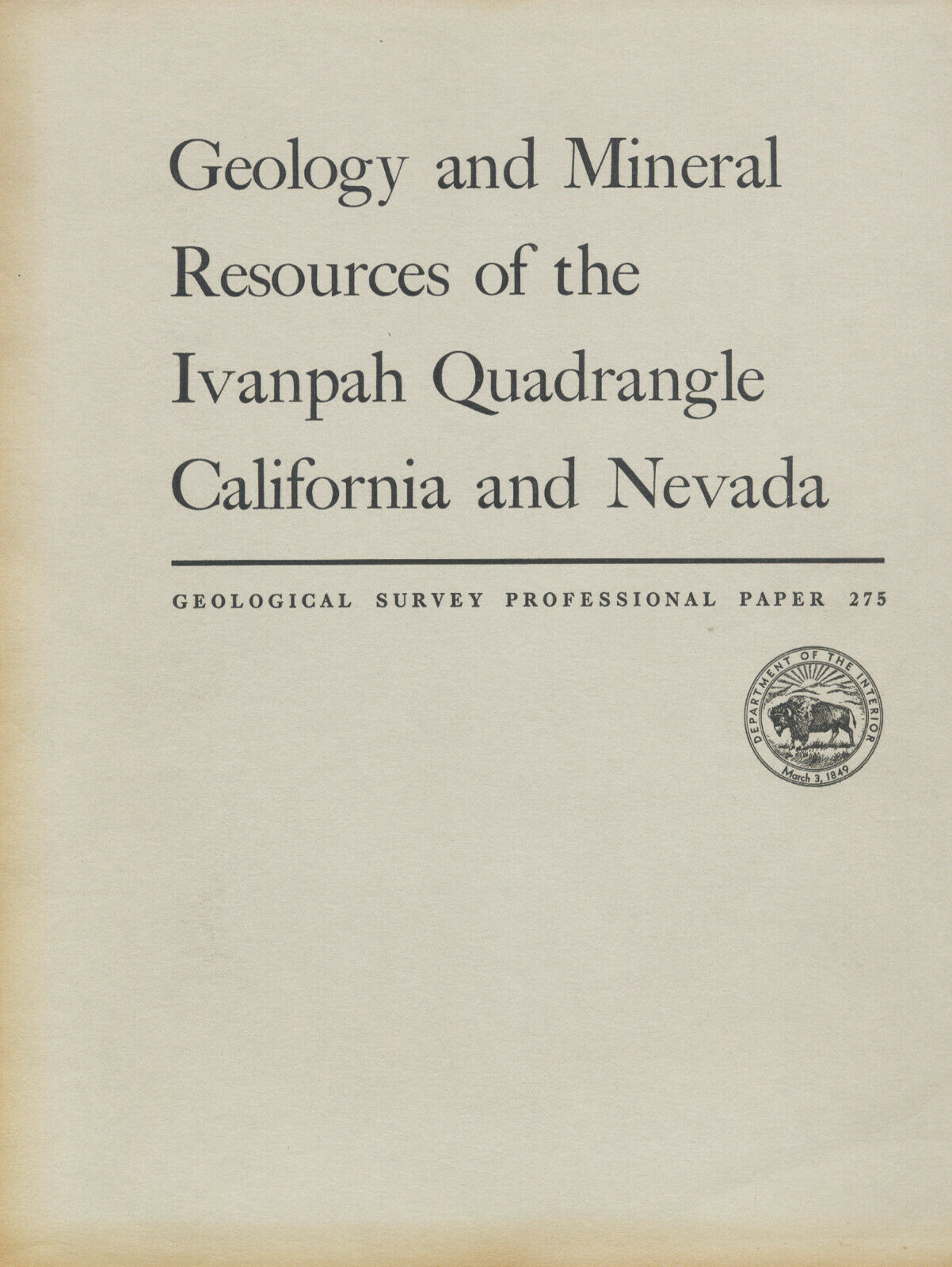
Yeah, the title says it's about the Ivanpah Quadrangle and says nothing about the East Mojave, but trust me ... It's all about California's East Mojave Desert. The Ivanpah Quadrangle is named for the Mojave ghost town of Ivanpah, home to one of the area's richest mines.
Don't expect another one of these reports to appear any time soon on ebay. The first edition is almost impossible to find, especially with the huge oversize maps.
4WD not needed
Yes, the area is remote, but where did you expect to find this many gold and silver mines? Next to the parking lot at Huntington Beach pier?
Sketch map of the underground workings of the Lucy Grey mine, in the Lucy Grey Range, west of the McCullough Range. The mine includes a 300-foot vertical shaft with levels at 80, 200 and 250 feet, totaling 1,100 feet in underground workings.
There are roads all through this area, and many of them are passable by regular old two-wheel-drive vehicles. That's right ... You don't need 4WD. You will, however, need a vehicle with highish clearance like a pickup truck or SUV.
If you have an SUV, here's your chance to safely use it for its designed use, instead of a trip to Trader Joe's for a couple of cases of Two-Buck Chuck. Get a little backcountry dust on it for a conversation starter the next time you take the Landcruiser to the Starbucks at the Irvine Spectrum!
First edition
This report is a first edition, in nice condition. It has both big separate maps bulging in the rear pocket.
This is not some little pamphlet; it has 172 pages. And that's why there is a postage charge for this baby. It's heavy! But oh boy is it worth every penny. It's packed with exact mine locations, geology, ore value, mine-production stats, history, fossil locales, even water-hole locations and analysis of the water from each water hole. And because it's 64 years old, it covers mines and fossil locations overlooked in more modern guides.
Prepared by the U.S. Geological Survey, this report is considered primary source material. So buy it now or forever hold your peace. Once it's gone it's gone.
Covers 4,000 square miles of East Mojave Preserve
The book locates all mines and important geologic features in the Ivanpah quadrangle, an area stretching from Baker, California, almost all the way to Las Vegas, Nevada — about
4,000 square miles
of largely remote unpopulated Mojave Desert, almost all of it falling within the borders of the East Mojave National Preserve.
It's hard to get a handle on just how much this book covers by looking at the map below. Best to get a copy of the AAA San Bernardino County map.
Some landmarks within the area covered include: the Devil's Playground, Kelso, Cima, the Mojave Road, Halloran Summit, Halloran Springs, Mountain Pass, Gold Valley, Woods Mountains, Lanfair Valley, Grotto Hills, Hole in the Wall campground, Ivanpah Valley, Clark Mountain, Nipton, the New York Mountains, the Kingston Range, the Shadow Mountains, Goodsprings, Turquoise Mountain (and the turquoise mines), Pinto Valley, Ivanpah, Vanderbilt, Cima Dome — the list goes on and on.
Map from book shows location of Ivanpah quadrangle in relation to Barstow, Kramer, Ludlow, Inyokern, Trona, Death Valley, Jean, Shoshone, Baker, Lone Pine, Las Vegas and the Nevada border.
The mines are sometimes located using landmarks, but all are located on one of the oversize maps from the report's rear pocket (see close up, below left). How can you look for gold, silver or minerals in mine dumps if you don't know where the best dumps are? Don't waste weekends randomly hammering away at barren rocks or digging through tailing piles for specimens. Also, because this report lists mine names, it is a valuable to collectors of stock certificates.
Mines and prospects covered include:
Tiny detail of color map from pocket shows gold and silver prospects at the Coliseum mine, Greens mine and Benson mine. "Au" is elemental symbol for Gold; "Ag" means silver. Numbers are keyed to a detailed explanation in the book. Numbers 62 and 63 are the Coliseum mine, about four miles north of Clark Mountain.
Coliseum mine
, near Clark mountain (see scan below right) — "At the time of examination (1929), the mine included numerous explorations . . . Ore was continuously mined and milled from 1931 to 1939 . . . One of the owners reports a recent shipment of six tons of quartz yielded 0 gross value."
Henry mine
, south slope of Shadow mountain — The vein has been stoped as much as 100 feet upward from the tunnel. "From 1913 to 1919, there is record of production of 35 tons of ore that contained about 2.90 ounces of gold to the ton and a little silver, copper and lead."
Paymaster mine
, seven miles north of Old Dad Mountain (near Baker) — Yielded ,000–0,000 in gold from 1910 and 1914. Water for the mill came from Indian Spring, five miles to the northeast. The workings explore a simple type of massive quartz vein in granite gneiss.
Marl Springs prospects
, near Marl Spring — "There are traces of an arrasta at Marl Spring and it is locally reported that some of these openings were made as early as 1860 by soldiers employed in patrolling the stage road that passed Marl Spring."
Vanderbilt mines
, in the New York Mountains — Shipped 693 ounces of gold, 2,511 ounces of silver, 5,000 pounds of copper and 1,854 pounds of lead in 1934 alone!
Stonewall mine
(silver) — discovered about 1870. Recent output had 500 to 750 ounces of silver per ton!!!
And many more mines and prospects
, large and small, famous and forgotten.
Famous turquoise mines
Gold, silver and copper aren't the only valuable materials mined in this area. It's also home to the world-famous turquoise mines: the Himalaya, the Stone Hammer and the Toltec.
Another detail from huge separate color map shows the Death Valley mine, which wasn't near Death Valley at all, but near Cima in the East Mojave Desert. Stock certificates from this mine turn up on ebay from time to time.
Besides a wealth of fossils, the area also has deposits of zinc, molybdenum, tungsten, tin, antimony, iron, fluorite, limestone, dolomite, magnesite, quartz, feldspar, mica, clay, perlite, gypsum, rare earth deposits (for which Mountain Pass is renowned) and talc.
Firsthand information
Okay, so you have a book by a "noted rockhound" or an "ace prospector." You might get lucky and find a couple of neat places, but you'll also hit plenty of absolute duds. Why? Because what rockhound, mine explorer or prospector in their right mind would give away their favorite productive locations? Not one. What they will give you are directions to sites that are picked clean or second rate at best. Don't rely on secondhand information when you can get firsthand info from this book.
Want to prospect or collect at virgin, undiscovered locations instead of ones already known? Then you'll need to find new areas with geologic attributes conducive to
containing the minerals or fossils that you're seeking. This book and map has that too (see map at above left). Who knows, maybe you'll discover the next Lost Burro gold mine.
Large maps folded in pocket
Like other sought-after mining and geology books about the Mojave Desert, the oversize folded maps are arguably the real prize here. They would look
great
framed if they weren't so useful in the field. Then again, you could have the best of both worlds: Make copies of them for the field, and frame the originals.
Sketch map of the Mescal mine, which lies high in the Mescal Range. Does the map tell you where this mine is? You bet!
The geologic map (detail, top right) is a
particularly handsome example of geologic cartography with pleasing colors and nicely executed calligraphy; they just don't make 'em like this any more.
Book describes
geology in detail
Because this is, after all, a book about mining
and
geology, it covers the latter topic in minute detail (almost 140 pages worth). The mineralogical features of the gold deposits are surprisingly similar throughout; mostly they differ slightly in the amount of sulfides present. The gangue is quartz in all except two and these lie in the Goodsprings dolomite. Pyrite is a persistent sulfide; chalcopyrite and galena are also found in a few. As for environment, 18 deposits are found in pre-Cambrian crystalline rocks, largely granite gneiss; eight are in Laramide intrusive rocks, largely Teutonia quartz quartz monzonite.
Of course, the text contains far, far more detail about geology — especially how it relates to mineral deposits and their formations — than just the previous paragraph. Geology varies widely over an area the size of this quadrangle, so it is impossible to convey but the simplest geologic features in an ad.
Where is it?
The Ivanpah Quadrangle is in the eastern part of the Mojave Desert in San Bernardino and Inyo counties, California. It also extends into Clark County, Nevada, coming to within a few miles of Las Vegas (see location map near top of ad). It contains 3,898 square miles, about 3,898 of which are in
California and 1,242 in Nevada. The quad is 69 by 56 miles. The eastern boundary comes within only 12 miles of the Colorado River. The southern part of the Death Valley trough is three to 10 miles west of the western boundary. I-15, the main route between L.A. and Vegas, crosses the quad diagonally. The Union Pacific Railroad also crosses it diagonally. The ghost town of Ivanpah is pretty much dead center in the middle of the quadrangle.
The book:
Geology and Mineral Deposits of the Ivanpah Quadrangle, San
Bernardino County, California
, U. S. Geological Survey Professional Paper 275, 1956, by D. F. Hewett, United States Government Printing Office. Washington, D.C., 172 pages, nine by 11 inches, 58 illustrations plus two huge maps in rear pocket, stiff paper covers.
In overall good to very good condition. Only real damage is to the spine, back cover and corners. Spine has some rips; corners have some bumps and bent pages. Inside pages and maps are in near-perfect shape. I challenge you to find one of these reports in better shape.
Two maps (one in full color) in pocket are folded with some slight rippling and slight wear along folds, otherwise in near fine condition. Book is NOT ex-library. All in all, one of the best copies that I have seen of this rare first edition.
As always, I am
extremely
conservative about rating book condition and very detailed in listing any potential flaw, no matter how slight. You get what you pay for. If you want a trashed book — filled with torn and dog-eared pages that the seller just "somehow forgot" to tell you about in his ad — then look elsewhere on ebay.
Payment and
domestic shipping
Paypal only. Sorry, that's what ebay has decreed.
I pride myself on bulletproof packaging and ship in sturdy cardboard boxes, or heavily reinforced padded envelopes. Yup, there's an extra postage charge for this baby because it's heavy and postage rates are going through the roof. No we don't do media mail. It takes forever; gets lost all the time and is much more subject to damage. Sorry.
The fine print:
Feel free to contact me if you have any questions about the item or terms of sale.
Do not
wait until you have bought the book.
I post feedback once a week. Not responsible for typograffical errors.
Good luck and thanks for looking!
Aerial view of the Shadow Mountains, south of Kingston Wash. Yes, all those little dots in the foreground are creosote bush, to give you an idea of scale.
Nearby Counties
The Ivanpah Quadrangle is in San Bernardino and Inyo counties, California, and extends
into Clark County, Nevada. Counties adjacent to Inyo are Mono, Fresno, Tulare, Kern
Map from book shows underground workings of the Green Monster mine, near Mesquite Valley. The mine shipped 5,152 ounces of silver, 72,256 pounds of lead and 684,250 pounds of zinc in 1916
and San Bernardino; nearby counties include: Riverside, Orange, Los Angeles, Santa Barbara, Kings, Madera, Mariposa, Tuolumne and Alpine.
Towns, population areas and interesting sites in Inyo County include Aberdeen, the Alabama Hills, Ancient Bristlecone Pine Forest, Badwater, Ballarat, Big Pine, Bishop, Cartago, Cerro Gordo, China Lake Naval Weapons Center, Coso Junction, Darwin, Death Valley Junction, Dolomite, Dunmovin, Eureka Sand Dunes, Fossil Falls, Furnace Creek, Haiwee Reservoir, Independence, Keeler, Laws, Lake Sabrina, Little Lake, Lone Pine, Mt. Whitney, Olancha, Owens Lake, Panamint Springs, Pearsonville, Saline Valley, Scotty's Castle, Shoshone, Stovepipe Wells, Swansea, Tecopa and Ubehebe Crater.
Other San Bernardino County cities and interesting sites (besides the ones previously mentioned in this ad) include: Adelanto, Alta Loma, Amboy, Apple Valley, Barstow, Barnwell, Baker, Big Bear Lake, Bloomington, Broadwell Dry Lake, Cadiz, Calico, Chino, Cima, Colton, Cucamonga, East Mojave, Essex, Etiwanda, Fontana, Forest Falls, George Air Force Base, Goffs, Grand Terrace, Havasu Landing, Helendale, Hesperia, Highland, Hinkley, Ivanpah, Joshua Tree National Monument, Kelso Dunes, Lake Arrowhead, Lanfair Valley, Loma Linda, Lucerne Valley, Ludlow, Mentone, Mitchell Caverns, Montclair, Morongo Valley, Mountain Pass, Mt. Baldy, Needles, Nipton, Ontario, Oro Grande, Parker Dam, Phelan, Pinon Hills, Pisgah Crater, Pomona, Rancho Cucamonga, Redlands, Rialto, Riggs, Route 66, Silver Lake, Soda Dry Lake, Upland, Twentynine Palms, Turtle Mountains, Yermo, Yucca Valley, Ward Valley, Zyzzx.
